Come visit us

rediscover nature

We are at your service to answer any question about our activities, the Rifugio and about our valley

Write to us, call us or follow us on social media

stay in touch with us

Chiedi informazioni

Opening Periods

May ➝ closed on Monday and Tuesday evenings
June ➝ closed on Monday and Tuesday evenings
July- August ➝ open daily
September ➝ closed Monday and Tuesday evenings
October ➝ open Thursday through Sunday

How to get to the refuge

The map to reach the Pian dell'Arma refuge in Caprauna

Take the SP 216, heading in the direction of Colletta/Nasino/Alto/Caprauna.
After having passed Caprauna, about 5.2 km later, there is a sign indicating the Rifugio on the right.
The dirt road is accessible to cars and leads to Pian dell’Arma after about 400 meters.

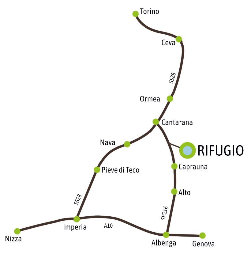
Take the SS 28, in the direction of Cantarana; from there (on the left for those coming from Ormea, on the right for those coming from Nava), take the SP216, in the  direction of Prale/Caprauna.
After passing the Colle di Caprauna, about 1 km later, there is a sign for the Rifugio on the left.
The dirt road is accessible to cars and leads to Pian dell’Arma after about 400 meters.

Located on the Alta Via dei Monti Liguri, the Rifugio Pian dell’Arma is a welcome point for those who are about to walk the ninth or eighth stage of the route depending on the direction, between the Prale Pass and the Colle di San Bartolomeo di Ormea (near Monte Armetta).
It is easily accessible thanks to the route’s visible signage throughout the entire Ligurian mountain range: red-white-red marks with the word AV written in the white part.

Calculate your itinerary to reach the Refuge by clicking here

At the Refuge you feel at home

Book your table and taste

the traditional specialties

Restaurant reservation
Allergies and intolerances
Vegetarian meals
Vegan meals